
Port Kells
The 2026 Surrey Neighbourhood Guide
What Port Kells Actually Is
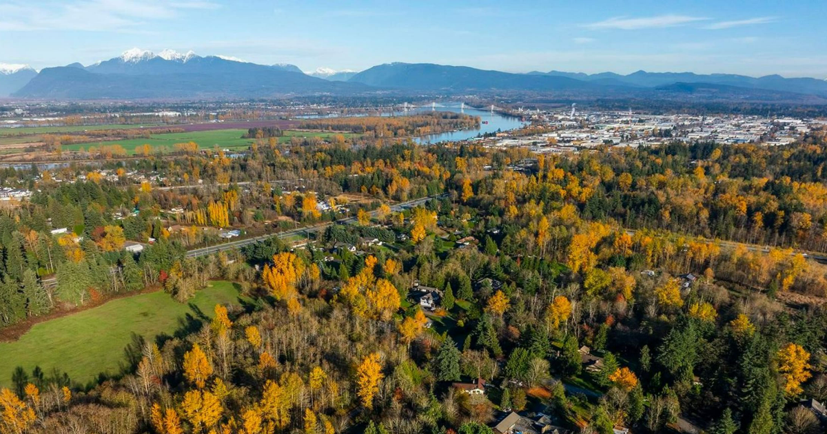
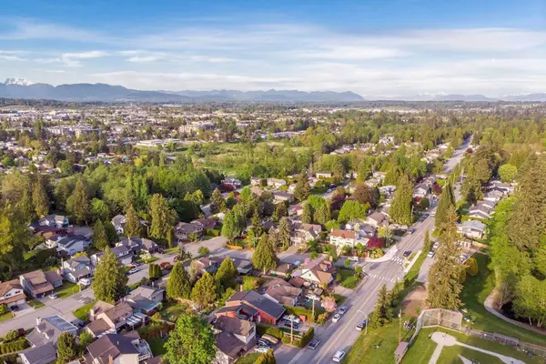
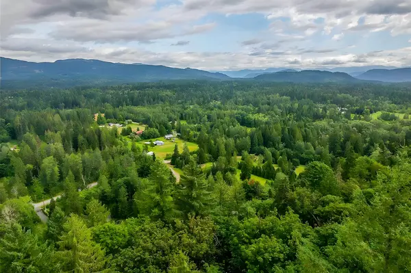
Port Kells sits on the far north-east corner of Surrey, pressed right up against the Langley city line. The boundaries run roughly from 176 Street east to 196 Street, & from 96 Avenue south to the Fraser River. The neighbourhood is wrapped by Highway 1 along the south edge, the river along the north, & a band of light industrial along 192 Street to the east. It's one of the lowest-density residential pockets in Surrey, with large lots, working farms still in operation, & big stands of remnant forest pressing right up against the residential streets.
For Surrey buyers, Port Kells is the acreage-feel detached edge of the city. The housing stock is a mix of 1970s & 1980s detached on 10,000 to 20,000 sqft lots, plus genuine 1-acre & 2-acre properties along the rural pockets, plus newer builds on some of the larger lots. There's almost no townhouse or condo inventory inside the boundary, the pocket is fundamentally a single-family-house place. Compared to Clayton or Bear Creek, Port Kells trades convenience for land, you're further from amenity but you get 2 to 4 times the lot.
The neighbourhood plays a specific role in Surrey: large-lot acreage-feel inside city limits, paired with unusually fast Highway 1 access. Port Kells gets the 176 Street & 200 Street interchanges on Highway 1, putting most addresses inside a 5-minute drive of the freeway. Tynehead Regional Park, a 263-hectare protected forest, sits right against the south edge.
The Bottom Line
Port Kells is the acreage-feel far-east corner of Surrey, anchored by the Highway 1 spine, the 263-hectare Tynehead Regional Park, & a band of light industrial along 192 Street. It suits buyers who want a real lot (10,000+ sqft, with some genuine 1-acre & 2-acre properties), Highway 1 access, & Pacific Academy on the doorstep. Detached prices $1.55 Million to $2.25 Million, acreage properties higher, almost no townhouse or condo inventory.
Vibe
Acreage Edge
Primary Commute
Highway 1 Direct
Established
1970s to Today
Detached Prices
$1.55 Mil to $2.25 Mil
Townhouse Prices
Limited Inventory
Condo Prices
Limited Inventory
Who Port Kells Is Best For
Port Kells is a niche. It works for a small set of buyer profiles, mostly people who specifically want land:
- •Large-Lot Detached Buyers: Couples or families who want a real 10,000 to 20,000 sqft lot inside city limits, with room for a shop, an RV pad, kids' play space, & a garden, all in the $1.55 Million to $2.25 Million range.
- •Hobby Acreage Buyers: Buyers chasing a true 1-acre or 2-acre property with municipal services for $2.5 Million to $3.5 Million, the lowest entry to Surrey acreage outside South Surrey.
- •Highway 1 Commuters: Professionals who drive east into Abbotsford or west into Burnaby & need direct freeway access without crossing 88 Avenue or Fraser Highway traffic.
- •Pacific Academy Families: Families who choose the Pacific Academy private K-12 stream & want to live within a 5-minute drive of the campus.
Real Estate & Housing in Port Kells
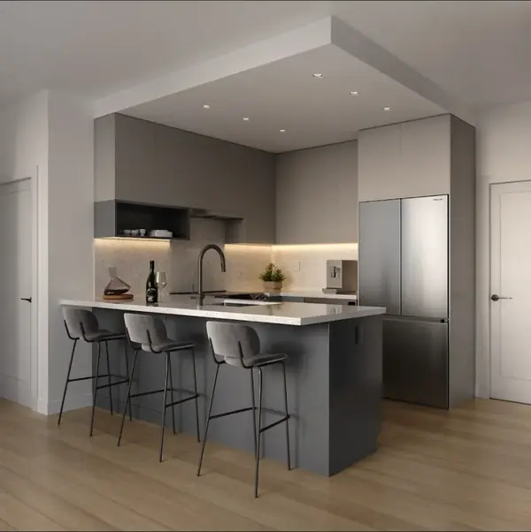
Port Kells is overwhelmingly detached. The interior streets are a mix of 1970s & 1980s 2-storey-with-basement homes on 10,000 to 20,000 sqft lots, plus a smaller pocket of genuine 1-acre & 2-acre properties along the more rural blocks. The benchmark band for typical large-lot detached sits in the $1.55 Million to $2.25 Million zone, with newer builds & well-renovated homes pushing $2.5 Million+. Acreage properties trade $2.5 Million to $3.5 Million, depending on lot size, structure, & whether services are at the property line.
What you're really paying for in Port Kells is land, not house. A typical $1.8 Million Port Kells home gives you twice the lot of a comparable Clayton or Fraser Heights detached, but the house is older & smaller. Buyers who plan to renovate or rebuild over a 5 to 10-year horizon often find the math works better here than buying a finished newer home in a denser pocket.
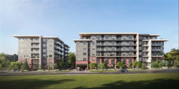
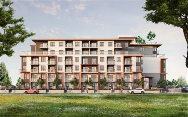
Townhouse & condo inventory is essentially nonexistent inside the boundary. There's no strata multifamily of any meaningful scale here, the pocket is structured around large-lot SFD use & some light industrial. Buyers who want townhouse or condo product will find it 5 to 10 minutes west in Cloverdale or Clayton.
Schools & Families
Public school coverage in Port Kells is spread between a few catchment elementaries. Erma Stephenson Elementary serves the central pocket, Hjorth Road Elementary handles parts of the south edge, & North Ridge Elementary picks up newer addresses on the far east. For secondary, most addresses catchment into North Surrey Secondary or Frank Hurt Secondary depending on exact street, both a 12 to 15-minute drive west. Catchments here shift more often than in dense Surrey pockets because enrolment is lower & catchment lines redraw more easily, always confirm by exact address with the Surrey School District before writing.
For private K-12, Pacific Academy is the major draw. The campus sits right at 192 Street & 96 Avenue, inside the Port Kells boundary, & runs a full K-12 program with strong academic, athletic, & arts streams. A meaningful share of Port Kells families choose Pacific Academy specifically because of the 5-minute drive, & it's a real reason some buyers pay the Port Kells premium over a similar lot in Cloverdale.
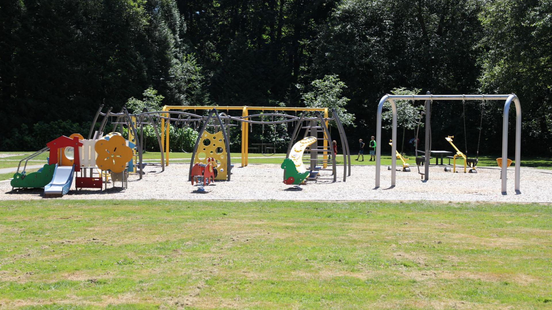
Family infrastructure beyond the schools is thin. There's no community centre inside the boundary, the closest is the Surrey Sport & Leisure Complex 12 minutes west in Fleetwood. Daycare supply is limited, most families use providers in Cloverdale or Fleetwood. Tynehead Regional Park on the south edge is the main outdoor anchor, with playgrounds, picnic shelters, salmon-bearing creek trails, & off-leash dog areas.
Commute & Getting Around
Port Kells has the most direct Highway 1 access of any Surrey neighbourhood. The 176 Street & 200 Street interchanges sit on the south edge of the boundary, putting almost every Port Kells address inside a 5-minute drive of the freeway. From there, you can be in Abbotsford in 25 to 30 minutes east or Burnaby in 35 to 50 minutes west, depending on the day. 200 Street is the main north-south spine, connecting you down into Cloverdale & Langley or up to the Golden Ears Bridge into Maple Ridge.
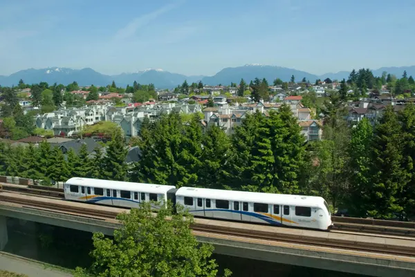
SkyTrain is not yet in Port Kells. The closest stations today are King George Station (15 to 20 minutes west) & Lougheed Town Centre (30 minutes north via Golden Ears). The future Surrey-Langley SkyTrain extension opens in 2029 with the new 196 Street / Bakerview Station only a 6-minute drive south of Port Kells, which improves the transit story significantly for anyone working downtown Vancouver.
Real-world drive times from a typical Port Kells address, with weekday morning traffic, look like this: Surrey City Centre 18 to 25 minutes, Surrey Memorial Hospital 18 to 22 minutes, downtown Vancouver 60 to 80 minutes, Burnaby (Brentwood / Metrotown) 45 to 60 minutes, Abbotsford 25 to 30 minutes, & YVR 50 to 70 minutes. Closer trips: Willowbrook Mall is 8 minutes, Costco Langley is 10 minutes, & Fort Langley is 12 minutes east.
Lifestyle, Shopping, & Amenities
Daily shopping is split between 2 hubs outside the neighbourhood. Most Port Kells residents do their main grocery & big-box runs at the Willowbrook commercial cluster 8 to 10 minutes south (Willowbrook Mall, Walmart, Real Canadian Superstore, Save-On-Foods, Costco, Home Depot), or at the Cloverdale Crossing & Highway 10 cluster 10 to 12 minutes south-west. Inside the boundary, the small commercial node at 96 Avenue & 192 Street handles the basics, a couple of restaurants, an A&W, a gas station, & a few service businesses.
Restaurant scene inside the boundary is light. For real dining, you head 8 to 10 minutes south to Willowbrook or 12 minutes east to Fort Langley's heritage restaurant district. The trade-off is real: Port Kells is not a walk-to-coffee neighbourhood, almost every errand is a 5 to 12-minute drive.
For weekend lifestyle, the location is unusually strong for outdoors. Tynehead Regional Park is on the south edge, Campbell Valley Regional Park is 12 minutes south, the Fraser Valley wineries & farm-stand circuit (Krause Berry Farms, Glen Valley) is 15 to 20 minutes east, & a Whistler day trip is 90 to 100 minutes north via Highway 1 to the Sea to Sky.
Outdoors & Recreation
Tynehead Regional Park is the headline outdoor anchor, a 263-hectare protected forest pressing right against the south edge of Port Kells with 13+ kilometres of looped trails, a salmon-bearing creek, off-leash dog areas, picnic shelters, & a hatchery. Port Kells Park at 96 Avenue & 184 Street is the local playground & sports field. Beyond that, Surrey Bend Regional Park (348-hectare riparian forest along the Fraser) is 8 minutes north for serious hiking, & Campbell Valley Regional Park in Langley is 12 minutes south for equestrian trails & old-growth forest. Together this is one of the best green-space-density pockets anywhere in Surrey for buyers who run, hike, or walk dogs daily.
What Works & What Doesn't
What Works
- Real 10,000 to 20,000 sqft lots, plus a few genuine acreage parcels.
- Direct Highway 1 access from 176 Street & 200 Street interchanges.
- Tynehead Regional Park on the south edge, 263 hectares of forest.
- Pacific Academy K-12 inside the boundary at 192 Street & 96 Avenue.
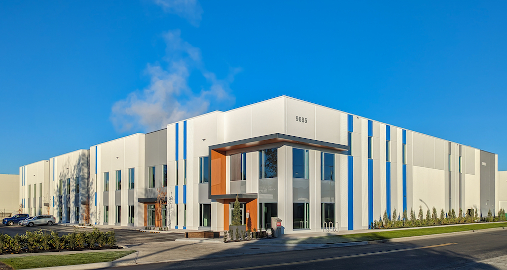
- Light industrial along 192 Street, walking-distance employer base.
- Future Bakerview SkyTrain Station just 6 minutes south, opening 2029.
Trade-Offs
- Older 1970s & 1980s housing stock, most homes need updates.
- No SkyTrain inside the boundary today, transit is bus-only.
- Very limited walkable retail or restaurants inside the boundary.
- Townhouse & condo inventory essentially nonexistent.
- Industrial fringe along 192 Street, truck noise during business hours.
- Public school catchments shift periodically, confirm before writing.
Free Download
The Surrey Relocation Guide
Neighbourhood maps, school catchments, commute tables, & a moving checklist, all in 1 download you can print or send to your spouse.
Frequently Asked Questions
Where exactly is Port Kells in Surrey?
Port Kells sits on the far north-east corner of Surrey, against the Langley line. The boundaries run roughly from 176 Street east to 196 Street, & from 96 Avenue south to the Fraser River. Highway 1 wraps the south edge & the Fraser River wraps the north edge. Pacific Academy sits inside the boundary at 192 Street & 96 Avenue.
How much does a detached home cost in Port Kells in 2026?
Realistic range for a typical 1970s or 1980s 2-storey-with-basement on a 10,000 to 20,000 sqft lot is $1.55 Million to $2.25 Million. Newer builds & well-renovated homes push $2.5 Million+. Genuine 1-acre & 2-acre properties trade $2.5 Million to $3.5 Million depending on lot size, structure, & whether municipal services are at the property line.
Are there acreage properties in Port Kells?
Yes. Port Kells has one of the largest concentrations of 1-acre & 2-acre properties inside Surrey city limits. Many sit along the more rural blocks east of 184 Street & along the river edge. Properties vary on whether municipal water, sewer, & gas are at the property line, always verify services & ALR status before writing.
Does Port Kells have a SkyTrain station?
Not inside the boundary. The closest existing SkyTrain station is King George 15 to 20 minutes west on the Expo Line. The future Surrey-Langley SkyTrain extension opens in 2029, with the new 196 Street / Bakerview Station only a 6-minute drive south of Port Kells, which gives you a one-seat ride into downtown Vancouver from a quick park-and-ride.
What schools serve Port Kells?
Public elementary catchments include Erma Stephenson Elementary (central pocket), Hjorth Road Elementary (south edge), & North Ridge Elementary (newer east-side addresses). For secondary, most addresses catchment into North Surrey Secondary or Frank Hurt Secondary depending on exact street. Pacific Academy private K-12 sits inside the boundary at 192 Street & 96 Avenue, & is one of the main draws for families choosing Port Kells. Always confirm public catchments by exact address with the Surrey School District.
Are there any townhouses or condos in Port Kells?
Essentially no. The pocket is structured around large-lot detached use & some light industrial, with no meaningful strata multifamily inventory inside the boundary. Buyers who want townhouse or condo product will find the closest options 5 to 10 minutes west in Cloverdale or Clayton.
How does Port Kells compare to Cloverdale or Fraser Heights?
Cloverdale (10 minutes south-west) has more amenity, walkable retail, deeper townhouse inventory, & a real downtown core, but smaller lots & no acreage. Fraser Heights (15 minutes north-west) has similar large-lot detached pricing with newer housing stock & no industrial fringe, but no equivalent Highway 1 interchange. Port Kells wins on lot size, Highway 1 access, & Pacific Academy proximity, Cloverdale wins on amenity, Fraser Heights wins on newer housing.
Is Port Kells Right for You?
Use these 4 questions as a quick gut check before you book a tour weekend in Port Kells:
- •Do You Want Land Over Newer House: If yes, Port Kells fits. If you want a 2015-or-newer build with no projects on a small lot, look at Clayton or Grandview Heights instead.
- •Is Highway 1 Your Main Commute: If you drive Hwy 1 east or west daily, Port Kells gives you the cleanest freeway access in Surrey. If your commute pulls you into downtown Vancouver via SkyTrain, Bear Creek or Whalley pencil better today.
- •Are You a Pacific Academy Family: If yes, very few neighbourhoods give you a 5-minute drive to the campus. The school proximity alone justifies the Port Kells premium for a lot of families.
- •Do You Need Daily Walkability: No grocery, no coffee shops, no walkable retail. Every errand is a 5 to 12-minute drive. If walkability is a hard requirement, look at Whalley or Cloverdale.
Next Step
Thinking about buying in Port Kells?
I show homes in Port Kells & the surrounding Surrey neighbourhoods every week. Book a 30-minute discovery call & we'll map out the right pocket, school catchment, & commute path for your situation, before you waste a Saturday on the wrong tour.
Book a Discovery CallFeatured Guides
Related Posts

About the Author
Alex Dunbar, REALTOR
Fraser Valley REALTOR at REAL Broker. Helping families relocate to Surrey, Langley, & Maple Ridge with a data-first, tech-forward approach.
Categories
Recent Posts


GET MORE INFORMATION