
Langley BC Neighbourhoods Guide (2026): Where to Live in Langley
By Alex Dunbar, REALTOR · REAL Broker BC Ltd. · Updated April 2026 · 9min read
Watch the map tour above, or read the 2026 written breakdown of every Langley neighbourhood below.
Langley BC sits east of Surrey and west of Abbotsford, on the south side of the Fraser River. It's 45 minutes to an hour from Vancouver via Highway 1 + the Port Mann Bridge. Inside the boundary, there are two municipalities (the small City of Langley + the much larger Township) and roughly a dozen distinct neighbourhoods, each with its own character, housing mix, and price band. This guide walks the map.
AT A GLANCE
Langley BC, Layout + Reach
TWO MUNICIPALITIES
City + Township
The small incorporated City of Langley, plus the surrounding Township. Different mill rates, different bylaws, different city services.
COMMUTE TO VAN
45 to 60 min
Highway 1 + Port Mann Bridge is the typical route. Pattullo through Surrey + New West is the backup.
SKYTRAIN BY
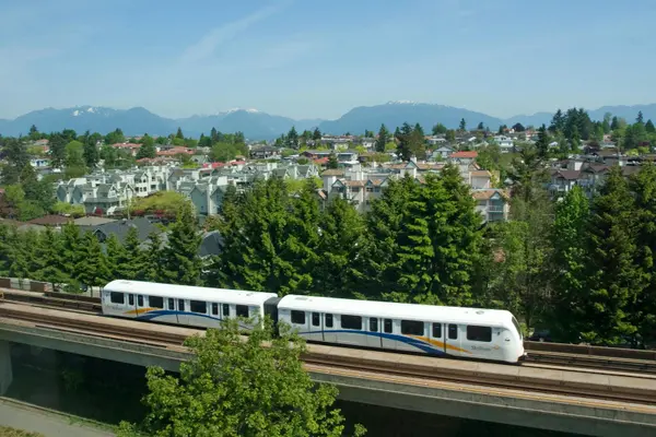
2029
The Surrey-Langley SkyTrain extension along Fraser Highway, terminating in Langley City Centre near 203 Street.
Langley borders Surrey at 196 Street + Abbotsford at 275 Street. South of Langley is the United States; north is the Fraser River with Maple Ridge + Mission across the water.
In This Guide
Every Langley Neighbourhood, Mapped

City vs Township: The Layout
First clarification most newcomers miss: Langley is two municipalities. The City of Langley is a small incorporated downtown core, primarily around 200 Street + Fraser Highway. The Township of Langley wraps the city completely and includes every other neighbourhood (Walnut Grove, Fort Langley, Willoughby, Brookswood, Murrayville, Aldergrove, Salmon River, County Line, Glen Valley, Otter District, Campbell Valley).
Borders:
- West: 196 Street separates Langley from Surrey.
- East: 275 Street separates Langley from Abbotsford.
- South: the United States border.
- North: the Fraser River, with Maple Ridge + Mission across the water.
When most people say "Langley", they mean both municipalities together. When you're looking at property taxes, school catchments, or city services, the distinction matters.
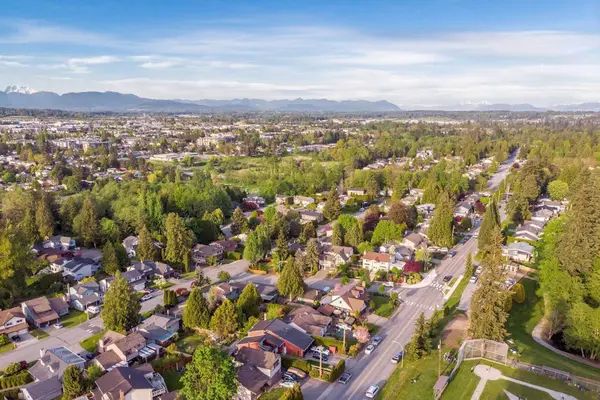
Walnut Grove (Northernmost Township Pocket)
The northernmost neighbourhood, sitting just south of the Fraser River + east of the Port Mann Bridge interchange. Family-focused, established streets, lots of detached homes, plus a meaningful supply of condos and townhomes. There's a notable concentration of age-restricted townhomes here, so confirm strata bylaws if you're a young family.
What stands out:
- Cineplex Colossus Langley, one of the largest theatre complexes west of Toronto.
- Walnut Grove Community Centre + Langley Events Centre nearby.
- Strong family schools, established trail network.
- Closest pocket to the Port Mann Bridge for Vancouver-bound commuters.
Detached homes typically run $1.5M to $2M+, with some older product on smaller lots in the lower band. Townhomes + condos make up most of the entry-level inventory.
Fort Langley (Heritage Village)
The historic core of Langley, often compared (in spirit) to Gastown in Vancouver. Substantial heritage protection has kept the village character intact and limited what major developers can do here. The result: a walkable village street, small businesses + cafes, river-front park access, and a meaningful price premium.
There are a small number of condo + townhome buildings, but inventory is limited and turnover is low. Detached homes near the village core trade at heritage-area premiums; older product in the surrounding streets can be more accessible. Buy here for the character, not the per-square-foot value.
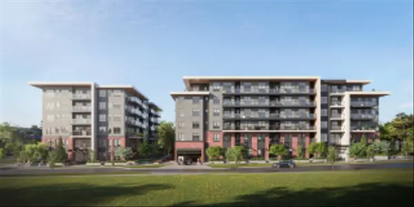
Brookswood (Larger Lots, Detached-First)
Brookswood is one of the strongest combinations in Langley: larger detached lots (9,000 to 10,000+ sq ft is common) at relatively accessible prices for the segment. There are essentially no townhomes or condos in Brookswood today, although some townhome product is in the planning + zoning pipeline.
Why families shortlist Brookswood:
- Largest typical lot sizes in suburban Langley.
- Strong tree canopy + established streets.
- Detached-only character (no high-density product to change the feel).
- Solid family schools.
Detached typically runs $1.4M to $2M, with the bulk of inventory in the $1.5M to $1.8M band. Worth touring even if it's not on your initial list.
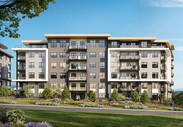
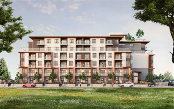
Willoughby Heights (Newest, Most-Developed)
The most-developed and still upcoming part of Langley. Yorkson was the early hub for new construction; recent development has moved north toward Carvolth, which now hosts Langley's major transportation interchange (the Carvolth bus loop + park-and-ride that feeds into Vancouver-bound commuter routes).
What you can find here:
- Strongest concentration of newer townhomes + condos in Langley.
- Newer detached product (often on smaller lots, 3,000 to 4,500 sq ft).
- Modern shopping at Willoughby Town Centre + the surrounding plazas.
- Future SkyTrain station proximity (depending on exact street, walking distance to a station may matter on resale).
Best fit for first-time buyers + young families who want newer construction, less maintenance load, and a wide range of property types in one neighbourhood. The trade-off is smaller detached lots vs Brookswood + Walnut Grove.
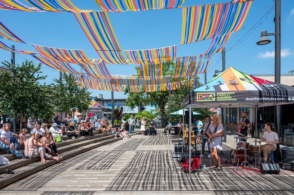
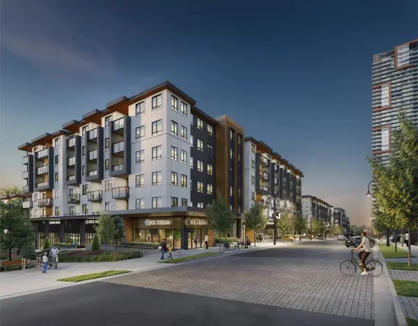
Langley City (Downtown Core, SkyTrain Future)
The City of Langley is the small incorporated downtown core of the broader region. It's the urban hub for shopping, restaurants, services, and (for many residents) where the day-to-day errands happen. The Surrey-Langley SkyTrain extension will terminate in Langley City Centre near 203 Street, opening around 2029.
What to know:
- A mix of detached homes, townhomes, and condos at often-lower prices than the surrounding Township.
- Older product is common; many lots could be redevelopment candidates under future zoning + density updates.
- The downtown also has visible homelessness + crime concentration in select pockets, generally contained to a few specific streets. Walk the area you're considering before committing.
- Strongest SkyTrain proximity benefit in Langley overall; expect repricing into 2029.
Excellent fit for buyers who want walkability + future transit access at lower entry prices. Shop carefully, the variance street-to-street is wider here than in any other Langley neighbourhood.
Murrayville + Aldergrove
Murrayville: an older, quieter area south of Langley City. Strong concentration of age-restricted condos, townhomes, and rancher-style townhomes (master-on-main layouts, popular with downsizers). Detached product tends to be on the older side, with a well-established neighbourhood character.
Aldergrove: the eastern edge of the Township, often missed by first-time tourers. Many people don't realize Aldergrove is part of the Township of Langley (rather than its own city). Older detached homes can start near $900K to $1M, the most accessible detached price band in Langley right now. Townhome + condo development is increasing but still smaller than Willoughby. The Aldergrove Lake area + community trails are a quiet local draw.
Both pockets are a good fit if you prioritize budget + space over proximity to the SkyTrain corridor. The longer commute is the trade-off.
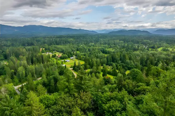
Rural East Langley (Salmon River, County Line, Glen Valley, Otter, Campbell Valley)
The acreage + equestrian zones of Langley. Larger lots, working farms + hobby farms, fewer big-box amenities, and a quieter way of life. Acreage product here ranges from sub-1 acre to 5+ acres, with workshops, outbuildings, and ALR-zoned land mixed throughout.
Quick characters:
- Salmon River: south of Highway 1, lots of larger properties, equestrian pockets, a popular semi-rural choice.
- County Line + Glen Valley: further north toward the Fraser, mostly acreage + farms, very few stores or services nearby.
- Otter District: near the US border, easy border access, some industrial parks, mostly larger lots.
- Campbell Valley: centred on Campbell Valley Regional Park, hobby farms + acreage, some industrial pockets toward the eastern edge.
Townhomes + condos are essentially nonexistent in these zones. Buyers here are committing to detached or acreage product, often with well + septic, and longer drives for daily errands. Confirm ALR + riparian + slope considerations before buying any acreage. The visible lot is not always the buildable lot.
The SkyTrain Corridor + Future Value
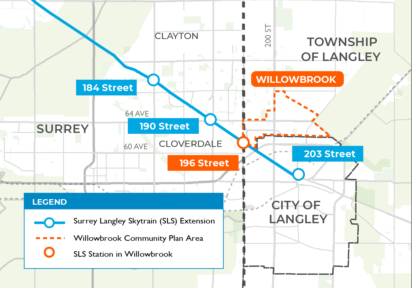
The single largest force on Langley pricing into 2029 is the Surrey-Langley SkyTrain extension. The line runs along Fraser Highway from the existing terminus near King George Station in Surrey, through Fleetwood and Clayton, into Willowbrook + Carvolth-area Willoughby, and ending at Langley City Centre near 203 Street.
Where the value rotation matters:
- Walking distance to a future station (one to three blocks): highest demand uplift through 2029.
- Directly on Fraser Highway: noise + vibration trade-offs eat into the upside; many buyers prefer streets just off the corridor.
- Far from any station: typical Langley pricing dynamics, less tied to the SkyTrain timeline.
The exact station locations + design treatments will continue to refine through construction. If SkyTrain access is a major part of your buying thesis, focus your search on Willoughby or Langley City pockets within a 5 to 10 minute walk of a future station, then pressure-test the noise + traffic story before removing subjects.
Frequently Asked Questions
What's the difference between the City of Langley and the Township of Langley?
They are two different municipalities. The City of Langley is the small incorporated downtown core (the area around 200th Street + Fraser Highway, where the SkyTrain extension will terminate). The Township of Langley wraps around it and includes everything else: Walnut Grove, Fort Langley, Willoughby, Brookswood, Murrayville, Aldergrove, Salmon River, County Line / Glen Valley, Otter, and Campbell Valley. Each sets its own mill rate, bylaws, and city services. When most people say "Langley", they mean both together.
Which Langley neighbourhood is best for families?
Walnut Grove, Brookswood, and Willoughby are the three most-shortlisted. Walnut Grove gives you mature streets, established schools, and the Langley Events Centre + Walnut Grove Community Centre. Brookswood gives you the largest lots in the typical buyer band ($1.4M to $2M detached on 9,000 to 10,000+ sq ft lots). Willoughby is the most-developed newer-product area, with the strongest concentration of newer townhomes + condos for first-time buyers + young families.
Where can I get a detached home in Langley for under $1.2M?
Aldergrove and pockets of Langley City are the only realistic options under $1.2M for detached in 2026. Both come with trade-offs: older product, sometimes smaller lots, or particular catchment + commute considerations. The next-cheapest tier is Murrayville, where rancher-style + age-restricted product can land below the $1.4M to $2M band but is rarely under $1.2M. Below that, you're in townhome territory.
Is Fort Langley actually worth the premium?
For buyers who value heritage + walkable village character, yes. Fort Langley is the historic core with extensive conservation effort to keep major developers out. The premium reflects the protected character + the limited supply (very few new condos or townhomes get approved). For buyers who would rather have a newer build with full modern systems for the same money, Willoughby or Walnut Grove deliver more square footage per dollar.
Where will the Langley SkyTrain stations actually be?
The Surrey-Langley SkyTrain extension will run along Fraser Highway with stations through Fleetwood (Surrey), Clayton, Willowbrook (near 200 Street), and ending at Langley City Centre near 203 Street. Pre-construction land within walking distance has already repriced upward. Service is currently targeted for 2029. Buyers who want SkyTrain access without front-line corridor noise should focus on streets one to three blocks off Fraser Highway, near a future station.
What's the trade-off of buying acreage in Langley?
Bigger property + more privacy + workshop potential, in exchange for: longer drives to amenities, no townhomes / condos / strata fees (good or bad depending on you), well + septic instead of municipal water + sewer in some pockets, ALR zoning + setbacks that limit what you can build, and a smaller buyer pool on resale. Salmon River, County Line, Glen Valley, Otter, and Campbell Valley are the typical acreage zones, with Brookswood's larger-lot product as the suburban middle ground.
Which Langley pocket has the most value upside through 2029?
Streets within walking distance of a future SkyTrain station, particularly in Willoughby + Langley City. The corridor announcement has already priced in some of the value, but proximity to a station + walkability + new-build inventory creates the strongest combination of demand drivers heading into 2029 + beyond. Detached lots near future stations have additional optionality (potential redevelopment under future zoning + density updates).
How does Langley compare to Surrey for first-time buyers?
Both Fraser Valley sub-markets, but with different lifestyle profiles. Langley feels more suburban / village-style, with more clearly defined neighbourhood identities (Brookswood, Fort Langley, Walnut Grove, Willoughby each have distinct characters). Surrey is bigger, more urban + diverse, with stronger transit today (existing SkyTrain) but a wider quality range. Many buyers who shop both pick Langley for the "neighbourhood character" feel and Surrey for the value + transit access. Visit both before deciding which fits.
Picking the right Langley pocket?
Let's match your wants, budget, and timeline to the right neighbourhood.
Book a 15-minute call. We'll go through your priorities (schools, lot size, transit, character, budget) and map them to the Langley pockets that actually fit. Or run the affordability math first with the Mortgage Calculator + grab the Langley Relocation Guide.

Alex Dunbar Personal Real Estate Corporation
REAL Broker BC Ltd. | Living in the Lower Mainland
I help Fraser Valley buyers + sellers pick the Langley pocket that fits their wants, budget, and timeline. Surrey, Langley, or Maple Ridge: book a 15-minute call and we'll narrow your shortlist before the showings start.
Featured Guides
Neighbourhood characters, prices, and SkyTrain timelines change. The descriptions above reflect 2026 conditions and the buyers I work with directly. Verify current pricing + timelines with your REALTOR before relying on these as the basis for an offer.
Categories
Recent Posts


GET MORE INFORMATION