
High Risk Flood Areas in Surrey BC [WATCH BEFORE MOVING TO SURREY BC]
Surrey Floodplains: Where You Should and Shouldn't Live 🌊🏘️
Climate change has brought severe weather and flooding into sharper focus, especially here in British Columbia. Recent forest fires and floods have made understanding local flood risks more crucial than ever. If you're considering a move to Surrey, BC, it's essential to know exactly where these floodplains are to ensure you choose a safe location for your new home. Let's dive into everything you need to know about Surrey’s flood zones.
🌧️ Understanding Flood Risks in Surrey
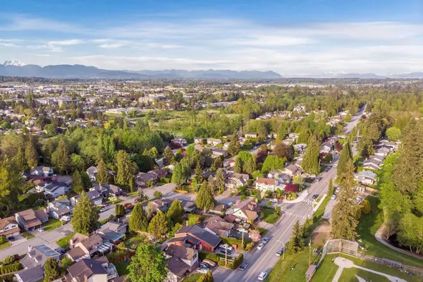
Surrey, BC, despite its many appealing neighborhoods, has several floodplain areas, primarily due to rising sea levels and storm surges. But it’s not just the ocean we need to watch—climate change is hitting from two directions. The two principal causes of increased flooding in Surrey’s coastal floodplain are, first, sea level rise, and second, the increased magnitude and intensity of rainfall. Both are direct results of our shifting climate, turning what used to be rare “once-in-a-lifetime” floods into far more frequent events.
So, whether you’re eyeing that charming spot near the river or considering a home closer to the coast, it’s essential to understand these evolving risks. Approximately 20% of Surrey’s land falls within flood risk zones, potentially impacting over 2,500 residents.
Key Areas of Flood Risk:
-
Fraser River (North Surrey, Fraser Heights, Port Kells)
-
Serpentine River (Fleetwood, Cloverdale, Serpentine area)
-
Nicomekl River (Cloverdale, parts of South Surrey)
-
Campbell River (Pacific Douglas, Hazelmere, King George Corridor)
-
Crescent Beach
🗺️ Surrey Floodplain Map Breakdown
North Surrey & Fraser River
-
Mostly industrial areas (Bridgeview, Boulevard Heights)
-
Limited residential housing, but areas near Highway 17 are vulnerable.
Fleetwood, Cloverdale, & Serpentine Areas
-
Primarily agricultural lands (ALR - Agricultural Land Reserve).
-
Significant flooding risks along the Serpentine and Nicomekl rivers, especially impacting farmland and some residential properties.
-
Highway 99 near Serpentine could become inaccessible during floods.
South Surrey: Crescent Beach & King George Corridor
-
Crescent Beach homes, though expensive, have no basement suites due to high flood risks.
-
Parts of Morgan Creek and King George Corridor areas also susceptible.
Pacific Douglas & Hazelmere
-
The Campbell River poses flooding risks in these southernmost neighborhoods.
-
Beautiful homes in Pacific Douglas near the US border could be impacted by flooding.
Mud Bay's Most At-Risk Infrastructure
Now, let’s zoom in on Mud Bay—one of the most sensitive floodplain areas in Surrey. If you’re considering the southwestern neighborhoods or have your eye on land west of 152 Street, here’s what matters: a lot of Surrey’s critical infrastructure sits here, and it’s especially exposed to flooding caused by climate change.
The types of infrastructure in Mud Bay most vulnerable to rising waters include:
- Transportation: This starts with roads (including major arteries), rail lines, and even airline runways. Flooding here doesn’t just mean local inconvenience; it could ripple out to impact regional and even national connections.
- Utilities: Power lines, gas pipelines, sanitary sewers, and essential pumping stations are directly in the line of fire during flood events. Damage here could mean widespread outages and disruptions.
- Flood Control & Marine Structures: Drainage pumps, sea dams, marinas, private docks, and the dykes themselves are all crucial defenses—and ironically also at risk if floodwaters overwhelm the system.
Why is this so important? Not only do these systems serve the local community, but failures here can affect much broader regions, making preparedness and awareness crucial for anyone planning to move into or around Mud Bay.
Mud Bay: How Surrey Assessed Flood Vulnerability
If you’re curious how the City of Surrey actually figures out which parts of Mud Bay are most at risk, here’s the inside scoop. Surrey’s city planners took a hands-on, collaborative approach by gathering together key players—think infrastructure managers, utility providers, and emergency services—for a focused workshop.
The Assessment Playbook
The workshop wasn’t just a talk shop. Participants used a systematic assessment tool—specifically, Engineers Canada’s PIEVC High Level Screening Tool—to break down risks to critical infrastructure. Here’s how they tackled it:
- Infrastructure Mapping: They looked at everything from roads, trails, and rail lines to utilities like power, gas, sewage systems, plus flood control measures like dykes and sea dams.
- Scenario Testing: The team evaluated different potential flood scenarios, including coastal surges (thanks to king tides and storm events) and rising river levels from the Serpentine and Nicomekl Rivers.
- Scoring Risk: For each “what if” scenario, they weighed the chances of it happening (probability) and what would happen if it did (consequences). Multiply those together, and you get a risk score.
- Pinpointing the Vulnerabilities: Special attention was given to where the highest risk scores landed—these are the parts of Mud Bay’s infrastructure that could take the hardest hit.
Planning for the Future
From there, the city discussed different strategies for the highest-risk spots. The three main options considered were:
- Protect: Strengthen defences (like raising dykes or improving pump stations).
- Accommodate: Modify infrastructure to live with more water (think flood-resilient roads or utilities).
- Retreat: In extreme cases, they might recommend pulling infrastructure back from the highest risk zones.
By taking this thorough approach, Surrey is laying out a roadmap for keeping Mud Bay as safe, dry, and resilient as possible—no matter what Mother Nature throws its way.
🚧 Surrey’s Flood Preparedness
Surrey boasts one of Canada's leading flood management systems, significantly reducing the overall flood risk. However, residents should always remain proactive and well-informed.
Key Actions for Prospective Buyers:
-
Use Surrey’s COSMOS Interactive Map for detailed flood risk areas.
-
Visit Surrey’s Flood Preparedness Page for regular updates and resources.
Further Reading & Resources
To help you make the most informed decision, Surrey provides a range of resources on flood adaptation and preparedness:
- Explore the City of Surrey’s for a deep dive into ongoing efforts and future planning.
- Review the for an overview of local flood challenges and strategies.
- Check out the for detailed adaptation solutions.
- For a technical perspective, the examines Surrey’s infrastructure resilience to flooding.
These resources, combined with real-time updates and mapping tools, will give you a comprehensive edge as you consider buying or moving within Surrey’s vibrant neighborhoods.
🏡 Planning to Move to Surrey? Let's Talk!
Choosing the right neighborhood in Surrey is critical, especially with flood risks in mind. Whether you’re buying your first home or relocating, I’m here to help you navigate Surrey’s housing market safely and confidently.
If you’re considering moving to Surrey and want to explore which neighbourhoods would suit you best, I’d be happy to help!
📞 Book a Call with Me: Schedule a Consultation
📢 Subscribe to my YouTube Channel: Living in the Lower Mainland
🏡 Looking for Homes in Surrey: Surrey Homes for Sale
📕 Download our FREE Surrey Relocation Guide: Ultimate Surrey Relocation Guide
Categories
Recent Posts


GET MORE INFORMATION